Trip Info
-
Manaslu
-
Hard
-
29 Days
-
Hotel/Trekking guest houses/Tent
-
2 - 15 People
-
March-May/Sep-Nov
-
7126m
Overview
An expedition to Mt. Himlung is more than just a climb. It’s a journey into the heart of the remote Peri Himal range of Nepal. Located northeast of the Annapurna and Manaslu regions, Himlung stands at an impressive 7,126 meters, demanding the attention of every adventurer. Its rugged terrain and challenging routes are guarded by steep faces and ridgelines, reserved for only the most experienced climbers. From the summit, you are surrounded by a vista of Himalayan peaks like no other, with Annapurna II, Gangapurna, and Tilicho Peak clearly visible.
The first ascent of Himlung was made by a Japanese team in 1992, marking the beginning of its popularity among mountaineers. Since then, many climbers have successfully reached the summit, mostly following the traditional route. This expedition will follow the conventional route, which requires fixed ropes and several high camps above the base camp. The climb involves mixed snow and ice climbing, with sections of pure rock climbing on high-quality granite. The final push to the summit includes steep snow slopes and ice climbing, often requiring ropes for safety, speed, and success. Due to the technical nature of the route, fixed ropes will be used for most of the climb above camp one, and prior experience with abseiling and mechanical ascenders (jumars) is mandatory.
Objective dangers on the Himlung route are minimal. The snow slopes are generally stable with a low avalanche risk, the rock is of good quality, and the mountain is below the reach of jet stream winds. However, the route is extremely exposed, and mistakes with rope work can be unforgiving. To ensure safety and success, we maintain a low client-to-guide ratio and employ experienced guides to keep you on track. Your guide(s) will handle the fixing of ropes and the smooth running of the expedition, with their primary concerns being client safety, service, and success.
Climbing Route & High Camps
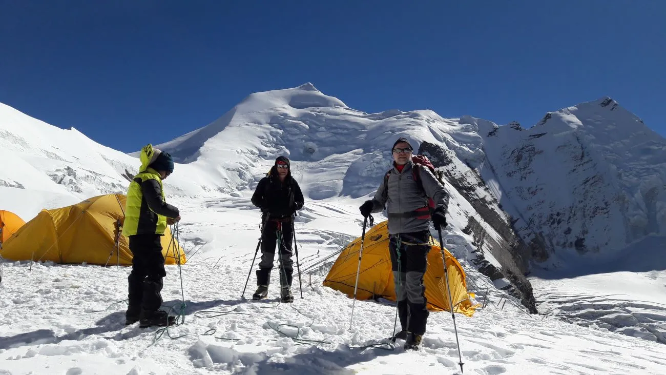
**Base camp (4,840 m):** Situated on a large grassy meadow with wonderful views.
**Camp I (5,450 m):** Our first real camp is only a few hours’ walk from base camp. This section involves boulder hopping and easy scrambling, with fixed ropes used as handrails in some sections.
**Camp II (6,000 m):** This section involves primarily rock climbing on high-quality granite, with challenging and exposed moves. The narrow ridge requires switching back and forth, with fixed ropes in place for safety. Good rock-climbing skills will help you move efficiently and quickly over this terrain.
**Camp III (6,350 m):** Now for the hardest snow and ice pitches of the route. We follow a system of steep snow and ice gullies to reach the Mushroom Ridge. This narrow, windy ridge leads to a small plateau at 6,300 meters, which serves as camp three.
**Camp three:** A cold and exposed position, camp three is the starting point for our summit push. Sherpas often use a full climbing rope to secure tents due to the wind funneling through this location. It is the only safe flat area within range of the summit.
**Summit day:** The initial route involves a moderately steep slope to the right of the large ice cliff. After this, we move toward the center of the face, with the angle easing slightly. After a couple of tough hours, we reach the summit (7,126 m), which offers ample space for moving around and taking pictures. The view includes many of the world’s highest peaks, along with numerous 7,000-meter and lesser peaks.
Highlights of the Expedition
– Climb the technically challenging peak, Mt. Himlung, with professional and experienced Sherpa guides.
– An acclimatization trek through the culturally rich regions of Nar and Phu.
– Pristine and remote Himalayan wilderness experience.
– Medical backup oxygen with a mask set at base camp.
– Excellent and comfortable logistics at Himlung base camp.
– Expert and experienced cook and crew.
– Expedition concludes with the successful summit of Mt. Himlung.
Trip Facts
– **Maximum elevation:** 7,126 m
– **Region:** Peri Himal, Nepal
– **Latitude, Longitude:** 28° 42′ N, 84° 28′ E